Chitose Air Base
Summary
| Operating Country | 🇯🇵 Japan |
| Location | 🇯🇵 Japan |
| Status | ◉ Active |
| Usage | Dual |
| Year built | 1926 |
| Operating Organization | Japan Air Self-Defense Force |
| Units |
|
Location & Details
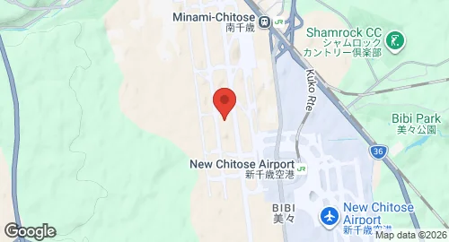
| Coordinates | 42.7944°N, 141.6664°E |
| Elevation | 27 m (89 ft) |
| ICAO code | RJCJ |
| Runways |
|
Description
Chitose Air Base is located in Chitose, Hokkaidō, adjacent to New Chitose Airport. The site originated in 1926 as a civilian airfield before the Imperial Japanese Navy assumed control in 1939. Following World War II, the United States Armed Forces occupied the base, utilizing it for maintenance, logistics, and as an emergency landing field during the Korean War. Major United States Air Force units assigned to the base included the 3rd Air Commando Group and the 49th Fighter Group. The 4th Fighter Group provided air defense for Hokkaidō from 1954 until 1957. Transfer to Japanese control began in 1957 and concluded in 1975. The facility served as the primary civilian airport for the Sapporo area until passenger services moved to the adjacent New Chitose Airport in 1988.
The Japan Air Self-Defense Force (JASDF) operates the base to monitor maritime borders with Russia. It hosts the 2nd Air Wing of the Northern Air Defense Force, which operates squadrons of F-15J and Kawasaki T-4 aircraft. Ground-based air defense is provided by the 3rd Air Defence Missile Group, which maintains Patriot missile fire units. Other resident units include the 8th Mobile Aircraft Control and Warning Squadron.
The base facilitates government transport through the Special Air Transport Corps, which operates Boeing 777-300ER aircraft. Search and rescue operations are conducted by the Chitose Air Rescue Wing using Mitsubishi UH-60J and U-125A aircraft. The facility and the neighboring New Chitose Airport are connected and function as a joint aviation complex.