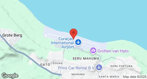
Curaçao International Airport, also known as Hato International Airport, is the sole airport serving the Dutch Caribbean island of Curaçao. Located on the north coast, 12 kilometers from Willemstad, it connects Curaçao to Europe, the Americas, and the Caribbean. The airport features one of the longest commercial runways in the Caribbean, capable of accommodating aircraft up to a Boeing 747. It serves as a main base for Divi Divi Air and EZAir. Historically, the airport was initially named Hato Airport, with its runway constructed in 1934. It was renamed Dr. Albert Plesman Airport on January 5, 1954. During World War II, Hato was a busy and important airport in the Caribbean, utilized by the United States Army Air Forces Sixth Air Force for anti-submarine patrols. In the 1960s, the runway was extended to accommodate the Boeing 747. Since 2013, the airport has been operated by Curaçao Airport Partners (CAP) under a 30-year concession, while Curaçao Airport Holding (CAH), owned by the government, retains ownership of the airport and surrounding land. Recent renovations in the 2010s included runway and taxiway upgrades, the opening of a new departure hall, and a dedicated Jet Centre for private aircraft. The airport also hosts military operations, including the Coast Guard Air Station Hato, which houses the Dutch Caribbean Coast Guard's Bombardier Dash 8 Maritime Patrol Aircraft and AgustaWestland AW139 helicopters. Additionally, a USAF Forward Operating Base (FOB) is located on the west end of the airport, supporting AWACS and transport aircraft.