RAF Ascension Island
Summary
| Operating Country | 🇬🇧 United Kingdom |
| Location | 🇬🇧 United Kingdom |
| Status | ◉ Active |
| Usage | Dual |
| Year built | 1939 |
| Operating Organization | Royal Air Force |
| Units |
|
Location & Details
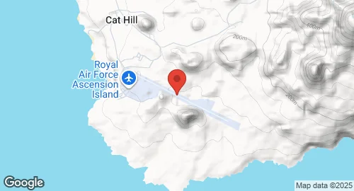
| Coordinates | -7.9694°N, -14.3939°E |
| Elevation | 78 m (256 ft) |
| IATA code | ASI |
| ICAO code | FHAW |
| Runways |
|
Description
RAF Ascension Island, also known as Wideawake Airfield, is a military airfield and facility located on Ascension Island in the Atlantic Ocean. The site became important in 1939 as a high-frequency direction finding radio station. The airfield itself was built by the US military in 1942 and opened on 10 July 1942, serving as a staging point during the Second World War. A U.S. Air Force tracking station, now administered by the U.S. Space Force, was officially activated in 1956.
The base was re-garrisoned by the RAF in 1982 and was extensively used as a staging airfield for Avro Vulcan bombers and Handley Page Victor tankers during the Falklands War, including for Operation Black Buck bombing raids. At one point during the conflict, Wideawake became the busiest airport in the world for aircraft movements.
The airfield is jointly operated by the Royal Air Force (RAF) and the United States Space Force (USSF). Under an international agreement, only state aircraft are generally authorised to land, with the exception of civil aviation between Ascension and Saint Helena. The facility hosts a U.S. Space Force ground tracking station, Detachment 2 of the 45th Mission Support Group, which supports the Eastern Range and rocket launches from Cape Canaveral Space Force Station. It also houses a high-frequency radio station as part of the Defence High Frequency Communications Service, operated by Babcock International Group.
The runway underwent significant repairs due to potholes, leading to the suspension of some flights in 2017. Repairs to the eastern portion of the runway were completed in August 2022, allowing full flight operations to resume, with the western side fully completed in April 2023. The station serves as a refuelling point for Ministry of Defence South Atlantic air bridge flights to RAF Mount Pleasant, Falkland Islands, from RAF Brize Norton, UK. It also functions as a diversion airport for ETOPS aircraft crossing the Atlantic.