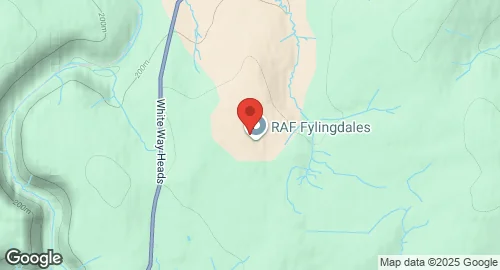
RAF Fylingdales
Summary
| Operating Country | 🇬🇧 United Kingdom |
| Location | 🇬🇧 United Kingdom |
| Status | ◉ Active |
| Usage | Military only |
| Year built | 1962 |
| Operating Organization | Royal Air Force |
Description
RAF Fylingdales is a Royal Air Force station located on Snod Hill in the North York Moors, England. It is a radar base, initially part of the Ballistic Missile Early Warning System (BMEWS) and now part of the Solid State Phased Array Radar System (SSPARS). The station's primary purpose is to provide the British and US governments with early warning of ballistic missile attacks. It also serves a secondary role in the detection and tracking of orbiting objects as part of the United States Space Surveillance Network, and provides a Satellite Warning Service for the UK to track spy satellites. The site was built in 1962 by the Radio Corporation of America (RCA) and became operational on 17 September 1963, originally featuring three 130-foot diameter radomes containing mechanically steered radar. Between 1989 and 1992, these domes were replaced by a tetrahedron ('pyramid') structure housing the AN/FPS-126 AESA phased array radar system, which was upgraded in 2007 to the Raytheon AN/FPS-132 Upgraded Early Warning Radar (UEWR). RAF Fylingdales is a British asset operated and commanded by the Royal Air Force, but it also forms one of three stations in the United States BMEWS network, with data shared between the two countries. The base has an active electronically scanned array (AESA) phased array radar system, providing 360-degree coverage with a tracking range of 3,000 nautical miles. The base is guarded by the Ministry of Defence Guard Service and Ministry of Defence Police.
