RRH Portreath
Summary
| Operating Country | 🇬🇧 United Kingdom |
| Location | 🇬🇧 United Kingdom |
| Status | ◉ Active |
| Usage | Military only |
| Year built | 1940 |
| Operating Organization | Royal Air Force |
| Units |
|
Location & Details
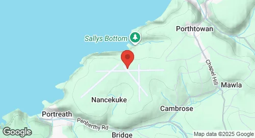
| Coordinates | 50.2714°N, -5.2633°E |
Description
Remote Radar Head Portreath, also known as RRH Portreath, is an air defence radar station operated by the Royal Air Force. It is located at Nancekuke Common in Cornwall, England. The station was built in 1940 and opened in March 1941 as RAF Portreath. During the Second World War, it served as an RAF Fighter Command station, a ferry stop-over for aircraft bound to/from North Africa and the Middle East, a temporary stop-over for United States Army Air Forces and Royal Canadian Air Force units, and later as an RAF Coastal Command station. By May 1950, it was handed back by the RAF.
From approximately 1950 to 1980, the site, then known as Nancekuke, became an outstation of the Chemical Defence Establishment (CDE) Porton Down. It was used for the manufacture and stockpiling of nerve agents Sarin and VX during the Cold War. Production of Sarin occurred from 1954 to 1956, and small amounts of VX were also produced for testing and plant validation. The chemical weapons production plant was mothballed in the late 1950s but maintained for potential re-commencement of production. Clean-up works on the site began in 2003.
The RAF re-opened parts of the site as a manned radar station in October 1980, serving as a Control and Reporting Post (CRP) for UK Air Surveillance. An underground CRP was built in 1986 as part of the UKADGE project, incorporating Marconi Electronic Systems radar systems. In the late 1990s, the installation became remotely operated, and the primary radar was replaced. The radar currently in use is a Type 102 Air Defence Radar, housed in a protective dome, providing long-range coverage of the south western approaches to the United Kingdom. Since May 1995, RRH Portreath has operated as a satellite of RAF St Mawgan for administration. As part of the HYDRA programme, the Ministry of Defence began upgrades to the site in 2020, including new communications buildings, radar towers, and perimeter security.