Culiacán International Airport (Bachigualato Federal International Airport)
Summary
| Operating Country | 🇲🇽 Mexico |
| Location | 🇲🇽 Mexico |
| Status | ◉ Active |
| Usage | Dual |
| Operating Organization | Mexican Air Force |
| Units |
|
Location & Details
| Coordinates | 24.7645°N, -107.4742°E |
| Elevation | 33 m (108 ft) |
| IATA code | CUL |
| ICAO code | MMCL |
| Runways |
|
Description
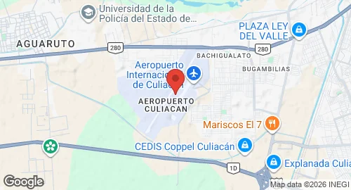
Culiacán International Airport, also designated as Bachigualato Federal International Airport, is located in the Bachigualato neighborhood, nine kilometers southwest of the city center of Culiacán, Sinaloa. The facility is operated by Grupo Aeroportuario Centro Norte and functions as a dual-use site, accommodating civil aviation and military installations for the Mexican Army.
Air Force Base No. 10 (B.A.M. 10) is situated at the southern end of the airport grounds. The base hosts Air Squadron 109, which operates Cessna 182 aircraft. B.A.M. 10 serves as a maintenance center for single-engine Cessna aircraft and Bell helicopters. Military infrastructure includes five hangars and facilities for Air Force personnel. The base features two aviation aprons measuring 13,800 square meters and 21,000 square meters, providing 30 parking positions for helicopters and small aircraft.
Civil infrastructure includes a main terminal with two aprons configured for ten narrow-body aircraft, along with a separate apron dedicated to general aviation. The terminal contains five gates, three of which utilize jet bridges. Additional facilities include civil aviation hangars, a dedicated general aviation terminal, and cargo and logistics centers. The airport supports flight training, executive aviation, and courier operations.