Little Rissington Airfield
Summary
| Operating Country | 🇬🇧 United Kingdom |
| Location | 🇬🇧 United Kingdom |
| Status | ◉ Active |
| Usage | Military only |
| Year built | 1937 |
| Operating Organization | Royal Air Force |
| Units |
|
Description
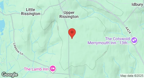
RAF Little Rissington is a Royal Air Force satellite station located in Gloucestershire, England. Constructed in 1937 and opened in 1938, it initially operated with a grass airfield. During 1942, three asphalt runways were laid and later extended. Until 1945, it accommodated No. 6 Service Flying Training School RAF and No. 8 Maintenance Unit RAF.
From 1946 to 1976, the station was home to the Royal Air Force Central Flying School (CFS) and various RAF aerobatics teams, including the Red Pelicans and the Red Arrows. The airfield closed in 1976 but was subsequently used by the Army as "Imjin Barracks" from 1977 to 1979.
From 1981 to 1994, it served the United States Air Forces in Europe (USAFE) as a military contingency hospital, cleared for Lockheed C-130 Hercules and Lockheed C-5 Galaxies. Following the USAFE withdrawal, the station was handed back to the Royal Air Force in 1994. Although initially identified as surplus, the aerodrome's disposal was halted after a Defence Review, and it has been retained by the Ministry of Defence as Little Rissington Airfield.
It remains active under the operational control of HQ No. 2 Flying Training School RAF. Its primary military unit is 612 Volunteer Gliding Squadron RAF, providing elementary flying training for Combined Cadet Force and Air Training Corps cadets. The airfield also functions as a relief landing ground, training area, and parachute dropping area for the forces. Recent investments include a new hangar for glider storage and maintenance, upgraded teaching facilities, an accommodation block, and groundworks for a grassed runway. A Neolithic long barrow on the eastern side of the airfield is a scheduled monument, which also served as an air-raid shelter during World War II.
Location & Details

| Coordinates | 51.8667°N, -1.7000°E |
| Elevation | 223 m (732 ft) |
| ICAO code | EGVL |
| Runways |
|