McLaughlin Air National Guard Base
Summary
| Operating Country | 🇺🇸 United States |
| Location | 🇺🇸 United States |
| Status | ◉ Active |
| Usage | Dual |
| Year built | 1947 |
| Operating Organization | US Air National Guard |
| Units |
|
Location & Details
| Coordinates | 38.3758°N, -81.5931°E |
| Elevation | 289 m (948 ft) |
| IATA code | CRW |
| ICAO code | KCRW |
| Runways |
|
Description
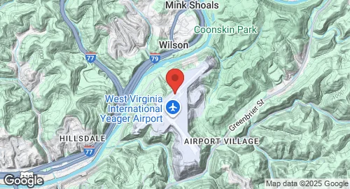
West Virginia International Yeager Airport (CRW/KCRW) is a public airport located 3 miles east of downtown Charleston, in unincorporated Kanawha County, West Virginia. It is owned and operated by the Central West Virginia Regional Airport Authority. The airport sits on a hilltop, approximately 289 meters above mean sea level. It hosts McLaughlin Air National Guard Base, which is home to the West Virginia Air National Guard's 130th Airlift Wing, an Air Mobility Command-gained unit operating C-130 Hercules aircraft. The airport also hosts Marshall University's Bill Noe Flight School, founded in 2021.
The airport opened in 1947 as Kanawha Airport, replacing the closed Wertz Field. A terminal was built in 1950. In 1985, the airport was named for then-Brigadier General Chuck Yeager, a native of Lincoln County. The terminal underwent renovation in 1986, and Concourse C was completed in 2001. In 2008, the secondary runway, 15/33, was closed to allow for the construction of new hangars and ramp space for additional C-130s. The airport was renamed West Virginia International Yeager Airport in 2021 following the completion of a U.S. Customs Building.
West Virginia International Yeager Airport covers 310 hectares and features one asphalt runway, designated 5/23, measuring 2,047 by 46 meters. An Engineered Materials Arresting System (EMAS) is installed at the end of Runway 5. In the year ending November 30, 2022, the airport recorded 38,083 aircraft operations, with 15% being military. As of November 2022, 66 aircraft were based at the airport, including 8 military aircraft. The airport serves various passenger airlines, including American Eagle, Breeze Airways, Delta Connection, and United Express, offering flights to destinations such as Charlotte, Newark, Orlando, Atlanta, Chicago–O'Hare, and Washington–National.