Rosecrans Air National Guard Base
Summary
| Operating Country | 🇺🇸 United States |
| Location | 🇺🇸 United States |
| Status | ◉ Active |
| Usage | Dual |
| Year built | 1940 |
| Operating Organization | US Air National Guard |
| Units |
|
Location & Details
| Coordinates | 39.7719°N, -94.9094°E |
| Elevation | 252 m (827 ft) |
| IATA code | STJ |
| ICAO code | KSTJ |
| Runways |
|
Description
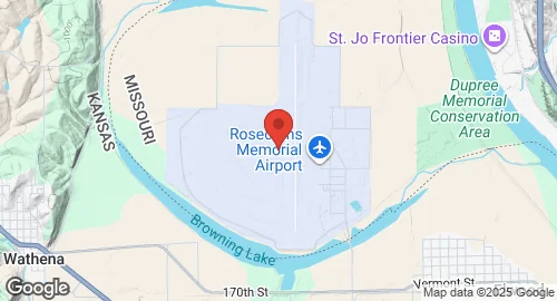
Rosecrans Air National Guard Base (Rosecrans ANGB) is situated near St. Joseph, Missouri, USA, on a portion of the Rosecrans Memorial Airport. The base is named in honor of Guy Wallace Rosecrans, a U.S. Army Air Service airman. Owned by the Department of Defense, it is operated by the US Air Force and controlled by the Missouri Air National Guard, maintaining an operational status.
Construction of the base began in the 1940s, initially established as St. Joseph Army Air Field by the U.S. Army Air Forces during World War II. On July 6, 1942, the Ferrying Division, Air Transport Command, assumed control, making it home to the 1st Operational Training Unit (OTU), which included various squadrons and detachments. In 1947, control transitioned to the newly formed U.S. Air Force. The base was subsequently conveyed back to the City of Saint Joseph in 1948, with 142 acres reserved for the Air National Guard, which had been organized in 1947. Temporary World War II-era barracks remained on the base until their destruction during the Great Flood of 1993.
Currently, the base's host unit is the 139th Airlift Wing (139 AW) of the Missouri Air National Guard. This wing operates C-130H2 Hercules theater airlift aircraft and is operationally gained by the Air Mobility Command (AMC). Rosecrans ANGB also hosts the Advanced Airlift Tactics Training Center (AATTC), a tenant activity that provides academic and combat flying tactics and training. This training is delivered to C-130 airlift aircrews from the Air National Guard, Air Force Reserve Command, active duty USAF, sister services, and allied nations, aiming to enhance aircrew survivability and mission success in combat environments. The airfield is shared with Rosecrans Memorial Airport. It features two runways: 17/35, measuring 2,456.9 meters with a concrete surface, and 13/31, measuring 1,462.1 meters with an asphalt/concrete surface. The base has an elevation of 252 meters.