Talara Air Base (El Pato Air Base)
Summary
| Operating Country | 🇵🇪 Peru |
| Location | 🇵🇪 Peru |
| Status | ◉ Active |
| Usage | Dual |
| Year built | 1942 |
| Operating Organization | Peruvian Air Force |
| Units |
|
Location & Details
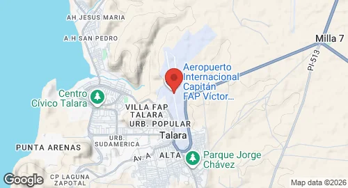
| Coordinates | -4.5764°N, -81.2541°E |
| Elevation | 85 m (279 ft) |
| IATA code | TYL |
| ICAO code | SPYL |
| Runways |
|
Description
Cap. FAP Víctor Montes Arias International Airport is located in Talara, within the Piura Region of Peru. During World War II, the facility served as a base for the United States Army Air Forces Sixth Air Force to conduct coastal defense operations against Axis powers submarines. United States personnel arrived on March 8, 1942, with the construction of barracks and support infrastructure beginning in August 1942.
Historical military units assigned to the base included the 336th Service Group, which provided logistical support. Flying units included the 397th Bombardment Squadron, operating LB-30 Liberators and A-17A Nomads, and the 51st Fighter Squadron, which operated P-40 Warhawks. The 3d Bombardment Squadron operated LB-30 Liberators, and the 91st Reconnaissance Squadron utilized B-25 and F-10 Mitchell aircraft. While most American units departed by July 1944, the 153d Communications Squadron maintained a station at the site until January 31, 1947, to provide communications training for Peruvian military personnel.
The airport is currently operated by Aeropuertos del Perú S.A. (AdP S.A.). It functions as a relief airport for Cap. FAP Guillermo Concha Iberico International Airport. The Peruvian Air Force operates El Pato Air Base, which is situated 4.5 km northeast of the main airport facility.