Louisville Air National Guard Base
Summary
| Operating Country | 🇺🇸 United States |
| Location | 🇺🇸 United States |
| Status | ◉ Active |
| Usage | Dual |
| Year built | 1941 |
| Operating Organization | US Air National Guard |
| Units |
|
Location & Details
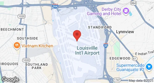
| Coordinates | 38.1742°N, -85.7364°E |
| Elevation | 153 m (502 ft) |
| IATA code | SDF |
| ICAO code | KSDF |
| Runways |
|
| Website | www.flylouisville.com |
Description
Louisville Air National Guard Base is located at Louisville Muhammad Ali International Airport in Louisville, Kentucky. The site was established in 1941 as Standiford Field by the U.S. Army Corps of Engineers. The field remained under the control of the United States Army until 1947, when it was turned over for commercial operations. The Kentucky Air National Guard relocated its base to this location in the 1990s.
The base is operated by the Kentucky Air National Guard and hosts the 123rd Airlift Wing. The unit's primary mission is the operation of transport aircraft. The 123rd Airlift Wing operates Lockheed C-130 Hercules aircraft from the installation.
Infrastructure at the site is integrated with the larger airport complex, which serves as a port of entry and a global cargo hub. Facilities include a control tower and hangars for aircraft maintenance and storage. The base is co-located with the UPS Worldport air hub, and its operational capabilities are supported by the airport's three-runway configuration.