Reno Air National Guard Base
Summary
| Operating Country | 🇺🇸 United States |
| Location | 🇺🇸 United States |
| Status | ◉ Active |
| Usage | Dual |
| Year built | 1929 |
| Operating Organization | US Air National Guard |
| Units |
|
Location & Details
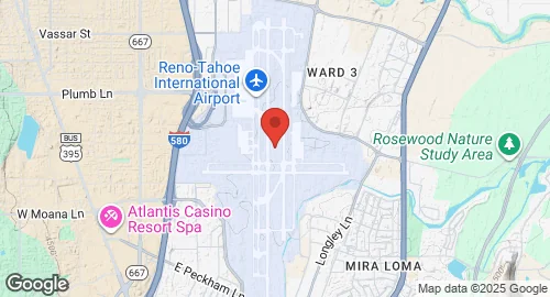
| Coordinates | 39.4992°N, -119.7681°E |
| Elevation | 1,346 m (4,416 ft) |
| IATA code | RNO |
| ICAO code | KRNO |
| Runways |
|
| Website | www.renoairport.com |
Description
Reno Air National Guard Base is a military installation located three miles southeast of downtown Reno in Washoe County, Nevada. Occupying a 60-acre complex on the west side of the Reno–Tahoe International Airport property, the base was established in 1954 when Nevada Air National Guard units relocated from the former Stead Air Force Base.
The base hosts the 152nd Airlift Wing (152 AW) of the Nevada Air National Guard. The wing is operationally gained by the Air Mobility Command (AMC). The installation supports the operation of C-130H Hercules transport aircraft. Military facilities are situated southwest of the airport's passenger terminal.
Wikipedia (CC BY-SA) and other open sources.
Suggest a change