Davison Army Airfield
Summary
| Operating Country | 🇺🇸 United States |
| Location | 🇺🇸 United States |
| Status | ◉ Active |
| Usage | Military only |
| Year built | 1949 |
| Operating Organization | US Army |
| Units |
|
Location & Details
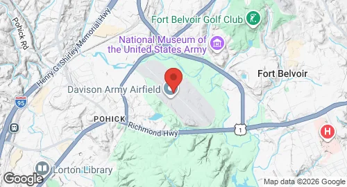
| Coordinates | 38.7150°N, -77.1811°E |
| Elevation | 73 m (240 ft) |
| IATA code | DAA |
| ICAO code | KDAA |
| Runways |
|
| Website | mdwhome.mdw.army.mil/taab/home |
Description
Davison Army Airfield is a United States Army facility located in Fairfax County, Virginia, 15 miles southwest of Washington, D.C. Serving Fort Belvoir, the airfield was established in 1952 and named for Brigadier General Donald Angus Davison. Between 1957 and 1976, the airfield supported the Army One presidential helicopter mission for presidents Eisenhower, Kennedy, Johnson, Nixon, and Ford. This role ended in 1976 when the responsibility transferred to the U.S. Marine Corps.
The airfield is operated by the U.S. Army and controlled by the Military District of Washington. The 12th Aviation Battalion, part of The Army Aviation Brigade, is the primary unit stationed at the facility. This unit is responsible for priority regional transport for U.S. Army and Pentagon senior leadership and operates the Pentagon helicopter pad.
Aircraft hosted at the airfield include UH-60 Black Hawk and VH-60 "Gold Top" helicopters, as well as UH-72 Lakota helicopters. The facility also serves as a base for the Civil Air Patrol National Capitol Wing, which operates Cessna 172 and 182 aircraft and maintains a tower on the site.