Hulman Field Air National Guard Base
Summary
| Operating Country | 🇺🇸 United States |
| Location | 🇺🇸 United States |
| Status | ◉ Active |
| Usage | Dual |
| Year built | 1943 |
| Operating Organization | US Air National Guard |
| Units |
|
Description
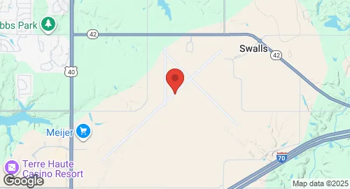
Terre Haute Regional Airport, also known as Hulman Field, is a civil-military public airport located six miles east of Terre Haute, Indiana, in Vigo County. Construction of the airport began in 1943 on land donated by Anton "Tony" Hulman, Jr., and it was dedicated on October 3, 1944. Initially, it featured three runways, taxiways, an apron, and a terminal building. A new terminal and control tower were completed in 1953, with apron expansion. The airport is owned by the Terre Haute Regional Airport Authority, a joint city-county entity formed in 1976.
The airport serves as the location for Hulman Field Air National Guard Base, home to the 181st Intelligence Wing (181 IW) of the Indiana Air National Guard since 1954. The 181 IW, operationally gained by the 16th Air Force, has a history of various aircraft, including the F-84F, F-100D/F, F-4, and F-16. Its flying operations ceased in 2007 due to a Base Realignment and Closure Commission mandate, leading to its redesignation as the 181st Intelligence Wing in 2008. The wing has supported multiple military operations, including Operation Southern Watch, Operation Noble Eagle, and Operation Enduring Freedom.
Terre Haute Regional Airport covers 1,475 acres and has two asphalt runways: 5/23 (9,021 ft) and 14/32 (7,200 ft). Runway 14/32 has a mixed asphalt/concrete surface. Indiana State University utilizes Hulman Field for its aviation program, and the USAF uses it for worldwide command and control of remote surveillance aircraft. The airport can also support F-16 and larger military aircraft as needed. Scheduled commercial service at the airport concluded in July 1999.
