Karup Air Base (Flyvestation Karup)
Summary
| Operating Country | 🇩🇰 Denmark |
| Location | 🇩🇰 Denmark |
| Status | ◉ Active |
| Usage | Dual |
| Year built | 1940 |
| Operating Organization | Royal Danish Air Force |
| Units |
|
Location & Details
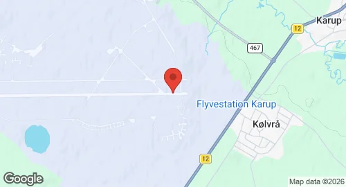
| Coordinates | 56.2975°N, 9.1247°E |
| Elevation | 52 m (171 ft) |
| IATA code | KRP |
| ICAO code | EKKA |
| Runways |
|
Description
Karup Air Base is situated 3 km west of Karup in mid-Jutland. The Luftwaffe constructed the facility in 1940 during the German Occupation under the name Einsatzhafen Grove to support offensive operations against England. It later functioned as a base for defensive fighter aircraft. Following the British advance into Denmark in May 1945, control passed to the Danish Civil Air Defence in December 1945, which utilized the site as a refugee camp. The Royal Danish Army assumed control in January 1946. In 1947, the Danish Army Air Corps established a flying school, maintenance center, and logistics office at the site. Upon the formation of the Royal Danish Air Force (RDAF) in 1950, the installation was designated Air Base Karup.
The Tactical Air Command was established at Karup in 1955. During the 1950s and 1960s, the base operated several aircraft types, including the Lockheed T-33 Shooting Star, Republic F-84 Thunderjet, RF-84F, and North American F-100 Super Sabre. In 1970, the RDAF stationed two squadrons of Saab 35 Draken strike fighters at the facility. The Army Operational Command moved to the base in 1993.
The base functions as the main air installation for the RDAF and hosts the operational commands for both the Royal Danish Army and the RDAF. Current units stationed at the base include the Helicopter Wing Karup, RDAF Flying School, RDAF Air Control Wing, RDAF Specialist School, RDAF Training Centre, Expeditionary Air Staff, and Operation Support Wing. The facility covers 3,000 hectares, with one third of the land located within the operational area defined by a 17 km perimeter fence. The base shares its runways with Midtjyllands Airport.