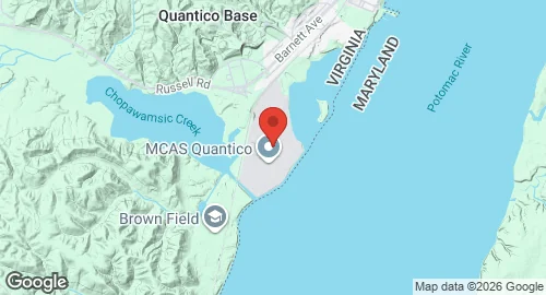
MCAF Quantico
Summary
| Operating Country | 🇺🇸 United States |
| Location | 🇺🇸 United States |
| Status | ◉ Active |
| Usage | Military only |
| Year built | 1931 |
| Operating Organization | US Marine Corps |
| Units |
|
Location & Details
| Coordinates | 38.5036°N, -77.3050°E |
| Elevation | 11 m (36 ft) |
| IATA code | NYG |
| ICAO code | KNYG |
| Runways |
|
| Website | www.quantico.marines.mil/mcaf/UnitHome.aspx |
Description
Marine Corps Air Facility Quantico is located within Marine Corps Base Quantico in Triangle, Virginia. Aviation activity at the site dates to 1896 and 1903 with unpiloted aircraft tests conducted by Samuel Pierpont Langley. In 1918, the Marine Corps began operating kite balloons and seaplanes at the junction of Chopawamsic Creek and the Potomac River. A flying field was established in 1919 and later named Brown Field. The current airfield location was selected in 1931 and named Turner Field. The installation was designated Marine Corps Air Station Quantico in 1941 and redesignated as Marine Corps Air Facility Quantico in 1976. In 2015, the facility was reorganized under the Marine Corps Installations National Capital Region.
The facility is operated by the United States Marine Corps and hosts Marine Helicopter Squadron One (HMX-1). Established at Quantico in 1947, HMX-1 is responsible for the helicopter transportation of the President of the United States. The squadron also conducts tactical development and provides support for the Marine Corps Combat Development Command.
Infrastructure at the facility includes the Olson air facility, dedicated in 2010 for the maintenance and storage of aircraft. The base hosts squadrons of various aircraft types, including the VH-3D and UH-3D Sea King, the VH-60N White Hawk, the UH-60N Black Hawk, and the MV-22B Osprey.