Facility Details
Map
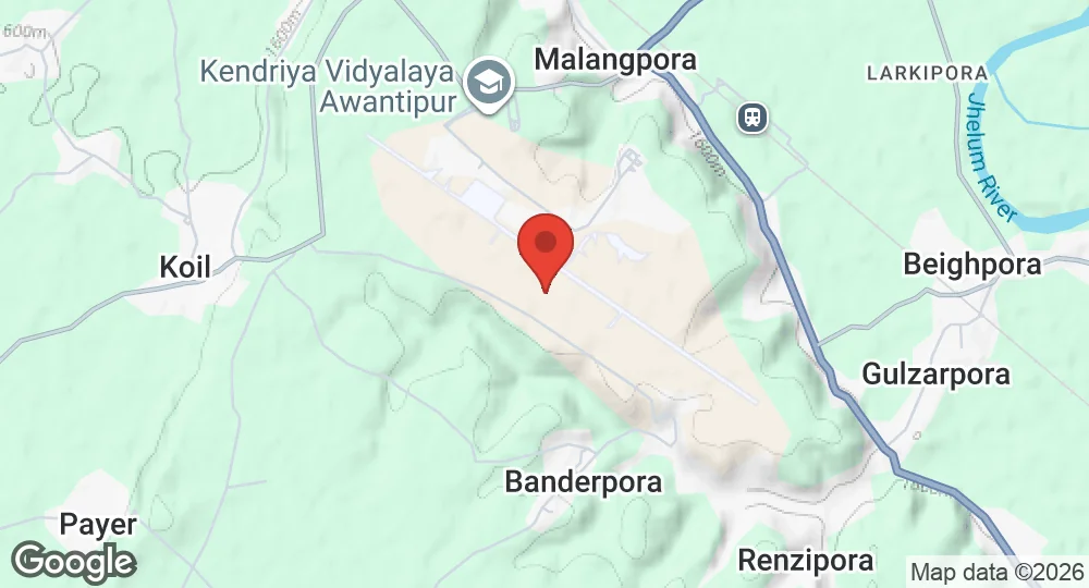
33.8764°N, 74.9756°E · 630 m elevation
Summary
| Operating Country | 🇮🇳 India |
| Location | 🇮🇳 India |
| Status | Active |
| Usage | Military only |
| Operating Organization | Indian Air Force |
| Units |
No. 3005 Squadron
|
Location & Technical Details
| Elevation | 630 m (2,067 ft) |
| ICAO code | VIAW |
| Runways |
12/30 · 3,200 m (10,499 ft) · Concrete
|
Related
Operating forces
More Indian Air Force bases
Description
Awantipur Air Force Station is a military airport operated by the Indian Air Force (IAF). It is located in Awantipora, Jammu and Kashmir, India, situated near Malangpora, approximately 5 km from Pulwama town. The air base is active and serves as a military installation. It features one concrete runway, designated 12/30, with a length of 3,200 meters (10,500 feet).
Wikipedia (CC BY-SA) and other open sources.
Last updated on 1 August 2026.
Suggest a change
Latest Data Updates
- AUG 12026 Updated Units added; runways updated
- APR 82026 Updated Sources and cross-references refreshed