Sam Ratulangi Air Force Base (Mapanget Airfield)
Sam Ratulangi Air Force Base (also Mapanget Airfield; ICAO WAMM) is an active joint civil-military airfield in Indonesia, operated by the Indonesian Air Force. It has 1 runway (2,650 m).
Facility Details
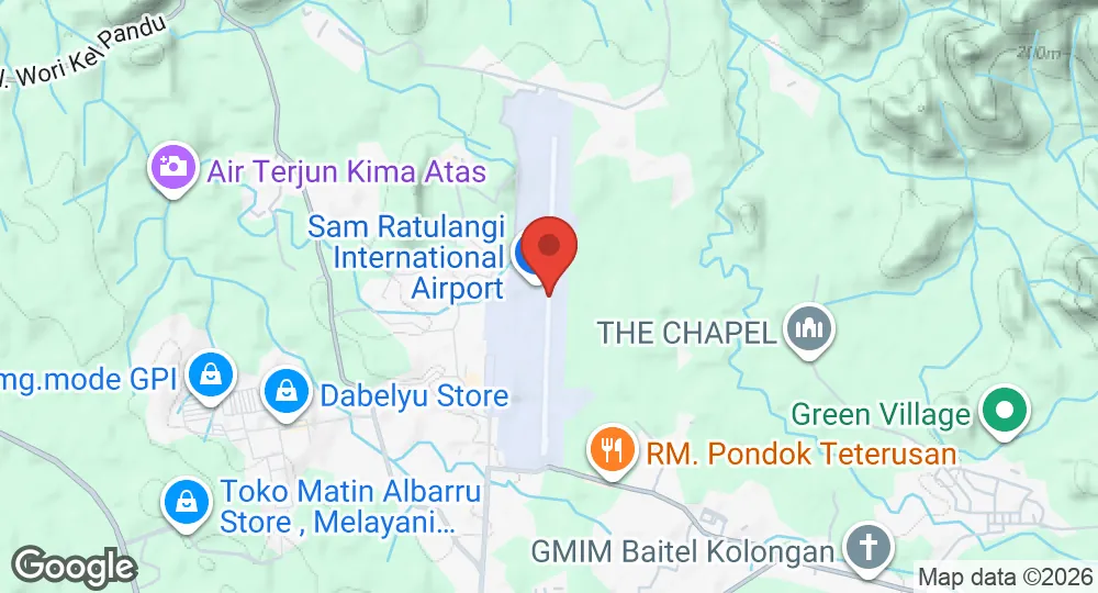
1.5492°N, 124.9264°E · 81 m elevation
| Operating Country | 🇮🇩 Indonesia |
| Location | 🇮🇩 Indonesia |
| Status | Active |
| Usage | Dual |
| Year built | 1938 |
| Operating Organization | Indonesian Air Force |
| Elevation | 81 m (266 ft) |
| IATA code | MDC |
| ICAO code | WAMM |
| Runways |
18/36 · 2,650 m (8,694 ft) · Asphalt
|
Description
Sam Ratulangi Air Force Base is located 13 kilometers north-east of Manado in North Sulawesi, Indonesia, near the Indonesian–Philippines border. The military facilities are situated east of the commercial passenger terminal, separated by the runway. The site operates as a Type A airbase for the Indonesian Air Force and hosts a Type B naval airbase under the Indonesian Navy's Naval Aviation Center (Puspenerbal).
The installation was established in 1938 when the Dutch colonial government constructed Mapanget airfield for fighter aircraft of the Royal Netherlands East Indies Army Air Force (ML-KNIL). Defended by the Manado Troop Command, the airfield was captured by Japanese paratroopers on 12 January 1942. The Japanese military converted Mapanget into a command base for operations targeting Kendari and expanded the facility to accommodate Mitsubishi G3M bombers.
In April 1958, Permesta rebels seized the airfield. It became the headquarters and primary operational base for the Revolutionary Air Force (AUREV), which operated fighter aircraft flown by foreign pilots to launch airstrikes against Balikpapan, Palu, and Ambon. On 15 May 1958, the Indonesian Air Force (AURI) struck the base with B-25 bombers and P-51 Mustang fighters, destroying parked AUREV aircraft, including a PBY Catalina. A second AURI assault on 9 June 1958 encountered strengthened anti-aircraft defenses, resulting in the loss of two attacking P-51s. Following its recapture by AURI forces, the military facility was sequentially designated Tugiman Airfield, Mapanget Airfield, and A. A. Maramis Airfield, prior to receiving its current name.
- AUG 132026 Updated Runway designations, surfaces and lengths recorded
- AUG 132026 Created Sam Ratulangi Air Force Base page created (specs, description, operators, static map)