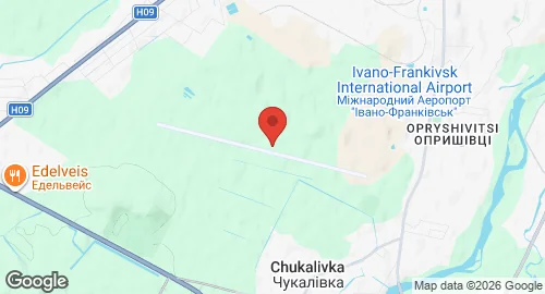
Ivano-Frankivsk International Airport (Opryshivtsi)
Summary
| Operating Country | 🇺🇦 Ukraine |
| Location | 🇺🇦 Ukraine |
| Status | ◉ Active |
| Usage | Dual |
| Operating Organization | Ukrainian Air Force |
| Units |
|
Location & Details
| Coordinates | 48.8842°N, 24.6861°E |
| Elevation | 280 m (919 ft) |
| IATA code | IFO |
| ICAO code | UKLI |
| Runways |
|
Description
Ivano-Frankivsk International Airport is located 4.4 km from the center of Ivano-Frankivsk, Ukraine, at the site of the former village of Opryshivtsi. It functions as a joint military-civil airfield. International border and customs operations have been maintained at the site since 1992.
The base currently hosts the 114th Tactical Aviation Brigade of the Ukrainian Air Force, which operates Mikoyan MiG-29 fighter jets. Historically, the 277th Mlavskiy Red Banner Bomber Aviation Regiment was stationed at the airfield from 1950 until May 1954. The civilian portion of the facility is guarded by the Chernivtsi Detachment.
Infrastructure includes an apron located northwest of the civilian terminal used by the Ukrainian Air Force. A concrete runway is utilized by the military for aircraft parking. Since 24 February 2022, the airfield’s airspace has been closed to civilian traffic. The facility sustained damage during an airstrike on 11 March 2022.